| Time: | 7 hrs |
| Distance: | 20 km |
| Fitness: | M |
| Skill: | EM |
| Ascent: | 440 m |
| Maps: | LPI Hilltop 8929-2N 1:25000 |
| Notes: | Print-friendly notes (opens in new window) |
Introduction

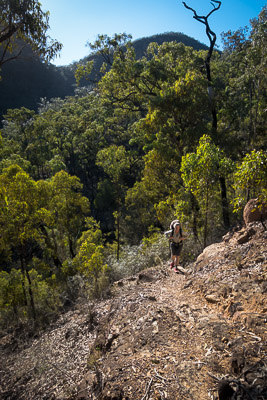
Descending the top of Troys Creek Track
Troys Creek Track provides a different route into the middle Nattai River, for those who are already familiar with Starlights Track.
While the route below is described as a day walk, there are various options for camping, making it a pleasant but fairly easy overnight walk. The walk as described exits via Starlights Track, but other options, including Slott Way, or Murrays Route up to Ahearn Lookout are possible. If you have not previously walked Starlights Track, the start of route from the campsites at the bottom can be confusing. It is of course also possible to exit via the Troys Creek Track as well.
The walk is best in the cooler months as there is a longish ridge walk at the start and a decent climb out to finish.
Access
The walk starts from the car park at the end of Wattle Ridge Road, in Hill Top.
Coming from Sydney, take the Hume Highway (M31) south, and take Exit 10 (Church Ave) signposted to Colo Vale, Hill Top and Yerrinbool. Turn right at the roundabout to cross the freeway, and then right again on to Wilson Dr after 1.6km, just before crossing the abandoned railway. After 5.2km turn left on to Chalker Parade, and then follow the road around to the right after it crosses the old railway line, and becomes West Parade. This takes you into the village of Hill Top, which includes the Hilltop Village Bakery and Cafe, opening early on the weekends.
Continue along West Parade. As the road veers north-west, it becomes Wattle Ridge Road. Not far out of the village the bitumen ends, and it becomes a generally good quality dirt road, 2wd accessible under normal conditions. Follow this to the car park at a locked gate, opposite the private property of Wattle Ridge. There is parking for around 8-10 cars, and an information board at the car park.
The car park can be busy on weekends so consider car pooling from Hill Top.
Track notes
From 13 Jul 2019, last checked 13 Jul 2019

Cliff views from the track
Pass through the locked gate to the west, and follow the fire trail around the perimeter of the Wattle Ridge property for 1.7km (25 min) to an intersection with a less distinct fire trail, and a signboard. Continue straight ahead on the more distinct trail, the Nattai Road, as opposed to the one to the left signposted Starlights Trail.
The walking is fairly flat and easy. The ridge generally heads NNW, and it is 4.7km (60 min) to an intersection with another fire trail, not signposted. The right hand branch descends into a creek, and follows it down to the Nattai River much further north, so keep to the left branch, passing another turnoff to the right after 70m. This trail swings west for 900m (10 min), and then SW at a small knoll where an overgrown fire trail heads off north.
After another 900m, the track starts to descend, and you start to get filtered views of the Nattai Valley opening up before you.
The track then does a couple of long contours, finally ending up in the rainforest gully of Troys Creek. The track stays fairly close to the creek, crossing to the SW side at 584038. After emerging from the rainforest, the track sidles away from the creek a little, but continues to follow the creek down to Emmetts Flat, a good spot for lunch.
If you are camping, while there is reasonable camping at Emmetts Flat, there are larger grassy camping areas across Troys Creek, opposite McArthurs Flat.
For water, Troys Creek is usually flowing, but can dry up after long dry periods, though there may be pools. Otherwise water can be taken from the Nattai River, but should be treated.
Pick up the start of Starlights Track from the eastern end of the grassy clearings. It shortly crosses over to the south side of Starlights Creek and heads up the steep slope to the SW. At the top of the steep section it contours in and out of gullies until it reaches creek level, before heading up to a rocky clearing. Continue for 250m to the fire trail at 618011 (Hilltop), and turn left. After 400m, you reach the junction with the original track you walked out on. Turn right and follow this back to your car.
Ascending via Starlights Track
Related walks
Bonnum Pic
Time: 7 hrs Distance: 16 km Fitness: EM Skill: M Ascent: 80 m
Spectacular views and interesting rock formations on this walk to a knife-edge ridge in the Wollondilly Valley
Starlights Track
Time: 5 hrs Distance: 13 km Fitness: EM Skill: EM Ascent: 440 m
Easy walk down to beautiful grassy campsites on the Nattai River
Couridjah Corridor
Time: 4 hrs Distance: 17 km Fitness: EM Skill: E Ascent: 100 m
Easy fire trail walking to the Little River, through one of the most impressive stands of Blue Gums around Sydney
Russells Needle
Time: 9 hrs Distance: 18 km Fitness: H Skill: MH Ascent: 700 m
Challenging walk with some scrambling to reach the top of an impressive knife-edge ridge
Box Vale Tramway
Time: 5 hrs Distance: 11 km Fitness: EM Skill: M Ascent: 180 m
A challenging walk involving an historic railway line, rugged river walking and an impressive waterfall
Ahearn Lookout
Time: 4 hrs Distance: 12 km Fitness: E Skill: EM Ascent: 80 m
A relatively easy walk to a spectacular lookout
Slott Way
Time: 5 hrs Distance: 11 km Fitness: EM Skill: EM Ascent: 450 m
A short steep route to the middle Nattai River, with views on the way in